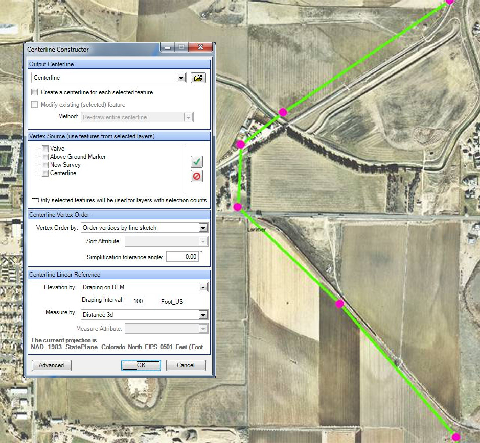
Create a measured centerline from a variety of vertices sources, including survey features, ILI inspection, and existing centerline data.
Centerline Design Toolkit is a comprehensive set of tools, which has been proven to make workflows more efficient and increase worker productivity. This easy-to-implement Esri ArcMap extension provides an extremely cost-effective way to quickly build accurate linear models. Its highly flexible design supports multiple data sources and offers a robust set of tools that perform complicated linear referencing operations. Yet, it’s easy to install and use, plus requires minimal training.
With Centerline Design Toolkit, common geo-processing workflows that used to take hours to perform, now take only minutes! For example, with just a few button clicks you can connect GPS points to create a line, assign 2D or 3D measures, and generate events with stationing. Centerline Design Toolkit not only improves GIS analyst productivity and simplifies the training process, it also simplifies centerline creation.
Create a measured centerline from a variety of vertices sources, including survey features, ILI inspection, and existing centerline data.
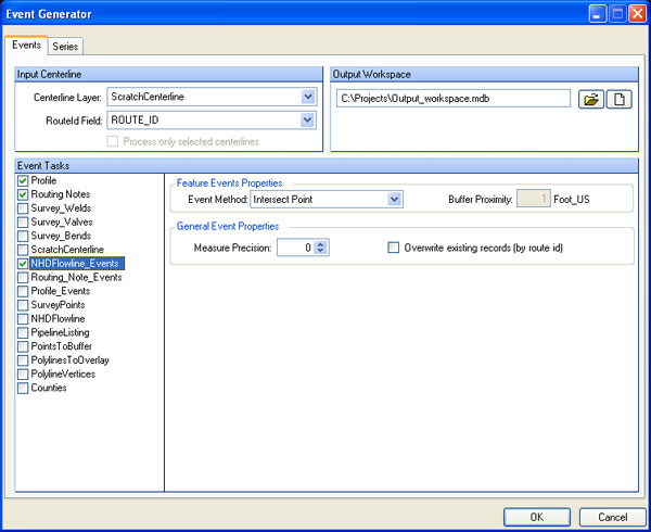
Event Generator calculates station and measure from other geographic features along the centerline to quickly generate events.
CENTERLINE DESIGN TOOLKIT is a trademark or registered trademark of New Century Software, Inc. Third party trademarks, trade names, product names and logos may be the trademarks or registered trademarks of their respective owners.