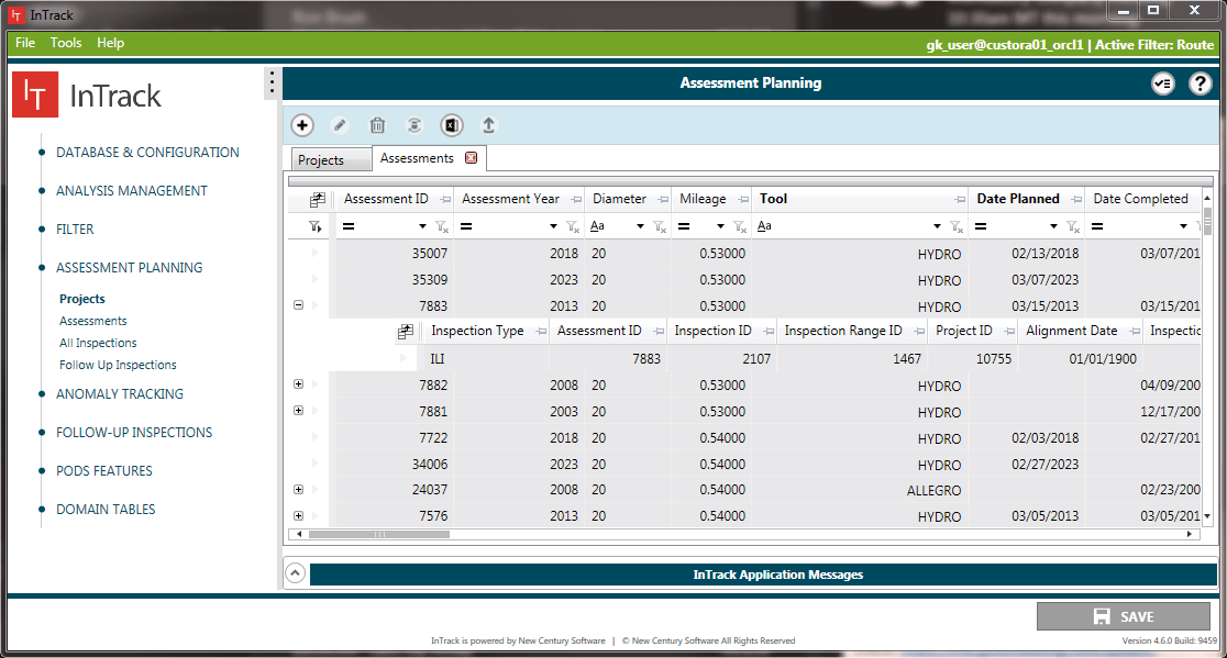
Create and monitor assessments.
InTrack is a planning and analysis application that integrates inspection data with your pipeline GIS and asset information. InTrack allows integrity and GIS teams to identify actionable anomalies that require remediation as well as plan for and schedule upcoming assessments. Built to efficiently manage the large datasets associated with ILI, CIS, and physical inspections, InTrack is the only application in the industry that manages and synchronizes GIS and inspection data allowing for real-time, accurate decision making.
InTrack’s configurable framework allows operators to select the features required to meet their IMP requirements and ensure a simplified process when managing complicated assessment data. It was built with Industry regulations at its core, namely 49 CFR 192 & 195, API 1163 and the upcoming API 1178. InTrack preserves a running history of the changing pipeline centerline through “snapshots” taken over time to monitor anomalies from discovery to remediation. With simple configuration and the ability manage large, year-over-year data sets, InTrack is an extendible and robust solution that can better identify actionable anomalies and lead to reduced assessment spending.
Create and monitor assessments.
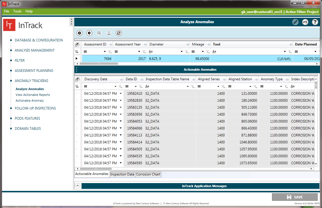
Track anomalies over time.
INTRACK is a trademark or registered trademark of New Century Software, Inc. Third party trademarks, trade names, product names and logos may be the trademarks or registered trademarks of their respective owners.